Leonardo da Vinci's Best Military Invention: The Aerial Map
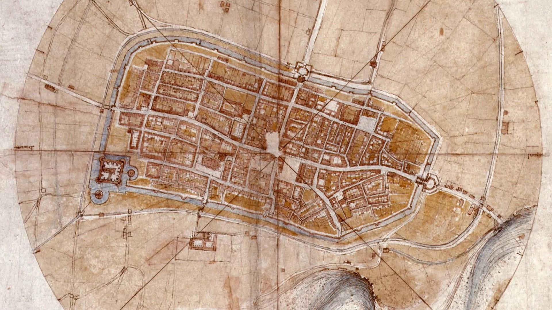
Leonardo da Vinci attaches himself to Cesare Borgia, a strongman in need of a military engineer and cartographer. In the villages seized by Borgia’s army, Leonardo surveys the fortifications, paces off distances and uses a compass to determine the measurements. He also gathers topographical data and draws meticulous maps featuring the hills and mountains, lakes and rivers of eastern Tuscany.
Paste this code where you want the video to appear.
TV Schedule Filters
Location Help
KET provides PBS national programming for all viewers in our broadcast areas. We use your web browser
to confirm your location.
If you're a KET donor, you may watch this content from anywhere in the United States.
We provide online video of PBS national programming for KET viewers. Please allow KET to access your web browser's location to watch this video.
Explore KET
Ad Blocker Detected
It appears your browser is using an ad blocker. In addition to blocking ads, this software affects our ability to properly detect your location, which we must do before allowing access to video content. Please add KET.org to your safe list or disable your ad blocker for the best experience.